
Mount Nangtud地形图
点击地图以显示海拔。
Mount Nangtud
Mount Nangtud is the second highest peak on the island of Panay, in the Philippines and third highest mountain in the Visayas, after Mount Kanlaon and Mount Madja-as. With an elevation of 2,074 m (6,804 ft) above sea level, it is located geographically within Jamindan, Capiz bordering with Barbaza, Antique. Mount Nangtud is famous for its "sea of clouds" and rich for its diverse flora and fauna and mossy forest. It is part of the Central Panay Mountain Range, the longest and largest mountain range in Panay and Western Visayas.
关于这张地图
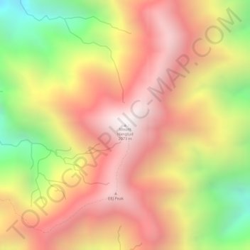
名称:Mount Nangtud地形图、海拔、地势。
地点:Mount Nangtud, Jamindan, Capiz, Western Visayas, Philippines (11.26787 122.20595 11.26797 122.20605)
平均海拔:1,578 米
最低海拔:888 米
最高海拔:2,034 米
其他地形图
点击地图以查看其地形、其海拔和其地势。