
Kidapawan地形图
点击地图以显示海拔。
Kidapawan
Within the Mt. Apo Natural Park is the Mandarangan Geological Site, which is being promoted as a major educational tourism site. Lake Venado, hidden among the mountain ranges, stands at an elevation of 7,200 feet (2,200 m) above sea level.
关于这张地图
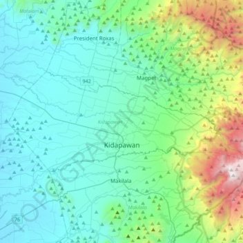
名称:Kidapawan地形图、海拔、地势。
地点:Kidapawan, North Cotabato, Soccsksargen, 9400, Philippines (6.97163 124.93130 7.11167 125.27078)
平均海拔:495 米
最低海拔:33 米
最高海拔:2,603 米
其他地形图
点击地图以查看其地形、其海拔和其地势。