
Alvarado地形图
点击地图以显示海拔。
关于这张地图
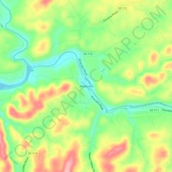
名称:Alvarado地形图、海拔、地势。
地点:Alvarado, Washington County, Virginia, United States (36.63067 -81.90679 36.67067 -81.86679)
平均海拔:580 米
最低海拔:520 米
最高海拔:654 米
其他地形图
点击地图以查看其地形、其海拔和其地势。
Clinch Mountain
United States > Virginia > Washington County
For its entire length, Clinch Mountain has only one true gap through which the ridge is completely sliced in half and continues as Clinch Mountain on either side, divided by Big Moccasin Creek. It is named Moccasin Gap and runs between Weber City and Gate City, Virginia. The Norfolk Southern Railway and U.S.…
平均海拔:618 米