
Sukun地形图
点击地图以显示海拔。
关于这张地图
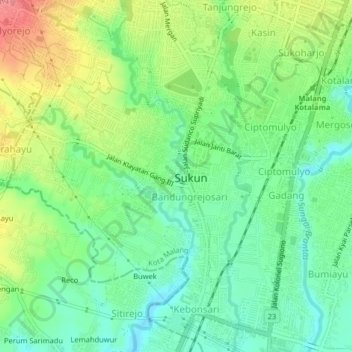
名称:Sukun地形图、海拔、地势。
地点:Sukun, East Java, Java, 65148, Indonesia (-8.02486 112.59688 -7.98486 112.63688)
平均海拔:431 米
最低海拔:400 米
最高海拔:481 米
其他地形图
点击地图以查看其地形、其海拔和其地势。
Malang
Indonesia > East Java > Kota Malang
The city was capital city of Singhasari in 1222, then transferred to Dutch colony. Malang was modernized under the Dutch; its mild climate which results from its elevation, along with its proximity to the major port of Surabaya, made it a popular destination for the Dutch and other Europeans. Malang began to…
平均海拔:490 米