
Barpeta地形图
点击地图以显示海拔。
Barpeta
It is located at 26°19′N 91°00′E / 26.32°N 91.0°E / 26.32; 91.0. It has an average elevation of 35 metres (114 feet). It is 40 km away from Manas National Park. Three rivers - Chaulkhowa, Mora Nodi (Dead River) and Nakhanda, both of which are tributaries to Brahmaputra run through the town.
关于这张地图
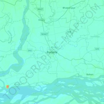
名称:Barpeta地形图、海拔、地势。
地点:Barpeta, Barpeta District, Assam, 781300, India (26.16578 90.84757 26.48578 91.16757)
平均海拔:40 米
最低海拔:31 米
最高海拔:174 米