点击地图以显示海拔。
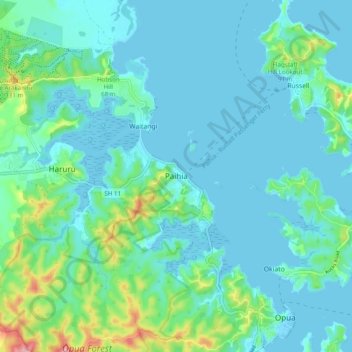
名称:Paihia地形图、海拔、地势。
地点:Paihia, Bay of Islands-Whangaroa Community, Far North District, Northland, 0200, New Zealand (-35.32187 174.04968 -35.24187 174.12968)
平均海拔:27 米
最低海拔:-1 米
最高海拔:161 米
点击地图以查看其地形、其海拔和其地势。
New Zealand > Northland > Far North District > Bay of Islands-Whangaroa Community > Paihia
平均海拔:14 米
New Zealand > Northland > Far North District > Bay of Islands-Whangaroa Community
平均海拔:7 米