
Forge Mill地形图
点击地图以显示海拔。
关于这张地图
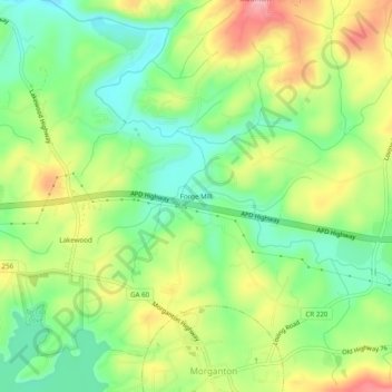
名称:Forge Mill地形图、海拔、地势。
地点:Forge Mill, Fannin County, Georgia, 30560, United States (34.87342 -84.26631 34.91342 -84.22631)
平均海拔:537 米
最低海拔:475 米
最高海拔:623 米
其他地形图
点击地图以查看其地形、其海拔和其地势。
Blue Ridge
United States > Georgia > Fannin County
Blue Ridge, situated in Fannin County, Georgia, lies within the rugged terrain of the southern Appalachian Mountains. The town itself is at an elevation of approximately 1,762 feet (537 meters) above sea level. The surrounding landscape is characterized by a series of ridges and valleys, with elevations…
平均海拔:535 米
McCaysville
United States > Georgia > Fannin County
McCaysville's weather is temperate due to its elevation and location in the southern Appalachians. Summers are warm with average highs in the middle 80s and lows in the lower 60s. Winters are cool with average highs in the 40s and average lows in the 20s. Rainfall is abundant with the yearly average…
平均海拔:484 米