
Independence Rock地形图
点击地图以显示海拔。
关于这张地图
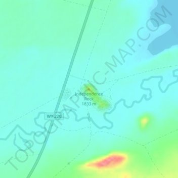
名称:Independence Rock地形图、海拔、地势。
地点:Independence Rock, Natrona County, Wyoming, United States (42.49408 -107.13261 42.49418 -107.13251)
平均海拔:1,802 米
最低海拔:1,786 米
最高海拔:1,871 米
其他地形图
点击地图以查看其地形、其海拔和其地势。
Midwest
United States > Wyoming > Natrona County
The town of Midwest, located in Natrona County, Wyoming, sits in a relatively flat, semi-arid landscape characterized by the rolling hills and gentle slopes typical of the Great Plains region. The area's topography is largely defined by expansive grasslands and isolated buttes. Midwest is positioned near…
平均海拔:1,482 米