Northern地形图
点击地图以显示海拔。
关于这张地图
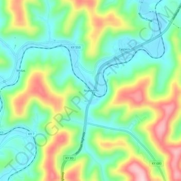
名称:Northern地形图、海拔、地势。
地点:Northern, Floyd County, Kentucky, 41622, United States (37.48788 -82.83544 37.52788 -82.79544)
平均海拔:285 米
最低海拔:197 米
最高海拔:446 米
其他地形图
点击地图以查看其地形、其海拔和其地势。

点击地图以显示海拔。
名称:Northern地形图、海拔、地势。
地点:Northern, Floyd County, Kentucky, 41622, United States (37.48788 -82.83544 37.52788 -82.79544)
平均海拔:285 米
最低海拔:197 米
最高海拔:446 米
点击地图以查看其地形、其海拔和其地势。