点击地图以显示海拔。
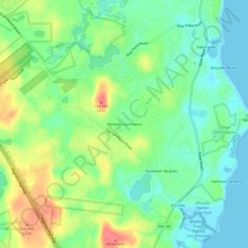
名称:Plimoth Commons地形图、海拔、地势。
地点:Plimoth Commons, Plymouth, Plymouth County, Massachusetts, United States (41.83766 -70.57336 41.87766 -70.53336)
平均海拔:24 米
最低海拔:0 米
最高海拔:64 米
点击地图以查看其地形、其海拔和其地势。
United States > Massachusetts > Plymouth County > Plymouth > Cedarville
United States > Massachusetts > Plymouth County > Plymouth > Cedar Bushes
平均海拔:14 米