
Genoa地形图
点击地图以显示海拔。
Genoa
The city of Genoa covers an area of 243 square kilometres (94 sq mi) between the Ligurian Sea and the Apennine Mountains. The city stretches along the coast for about 30 kilometres (19 mi) from the neighbourhood of Voltri to Nervi, and for 10 kilometres (6.2 mi) from the coast to the north along the valleys Polcevera and Bisagno. The territory of Genoa is popularly divided into 5 main zones: the centre, the west, the east, the Polcevera and the Bisagno Valley. Although much of downtown is located at a low elevation, the territory surrounding it is mountainous with undeveloped land usually being in steep terrain.
关于这张地图
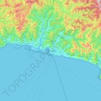
名称:Genoa地形图、海拔、地势。
地点:Genoa, Liguria, 16100, Italy (44.24726 8.77386 44.56726 9.09386)
平均海拔:247 米
最低海拔:-4 米
最高海拔:1,486 米