
Machilipatnam地形图
点击地图以显示海拔。
Machilipatnam
Salabat Jung, the son of Nizam-ul-Mulk Asaf Jah I, who was indebted for his elevation to the throne to the French East India Company, granted them in return for their services the district of Kondavid or Guntur, and soon afterwards the remainder of the Circars. The Circars were captured by the British from the French in 1759 and were returned to the Nizam. However Masulipatnam captured by the British during the Siege of Masulipatam was retained by the East India Company.
关于这张地图
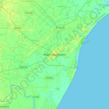
名称:Machilipatnam地形图、海拔、地势。
地点:Machilipatnam, Krishna district, Andhra Pradesh, 521001, India (16.02174 80.97482 16.34174 81.29482)
平均海拔:4 米
最低海拔:-4 米
最高海拔:13 米
其他地形图
点击地图以查看其地形、其海拔和其地势。