
Aux Sable地形图
点击地图以显示海拔。
关于这张地图
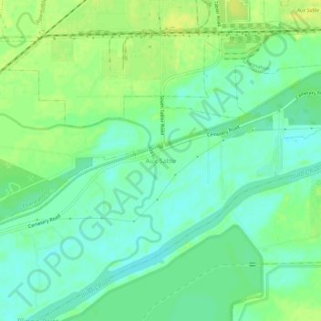
名称:Aux Sable地形图、海拔、地势。
平均海拔:156 米
最低海拔:147 米
最高海拔:165 米
其他地形图
点击地图以查看其地形、其海拔和其地势。
Morris
United States > Illinois > Grundy County
Morris is located in northeast Grundy County along U.S. Route 6 and Illinois Route 47 and on the north side of the Illinois River at an elevation of 515 feet (157 m).
平均海拔:162 米