
Abererch地形图
点击地图以显示海拔。
关于这张地图
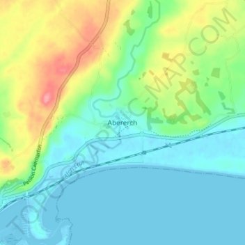
名称:Abererch地形图、海拔、地势。
地点:Abererch, Gwynedd, Wales, LL53 6BQ, United Kingdom (52.88327 -4.40091 52.92327 -4.36091)
平均海拔:27 米
最低海拔:-1 米
最高海拔:95 米
其他地形图
点击地图以查看其地形、其海拔和其地势。
Carneddau
United Kingdom > Wales > Gwynedd > Abergwyngregyn
The plants growing on the Carneddau need to be extremely hardy to withstand the snow, frosts, and gales they will encounter during the year and those found by sheltered streams in the valleys are very different from those clinging to crevices on windswept rocks. Sheep graze the mountains and impact the…
平均海拔:408 米