点击地图以显示海拔。
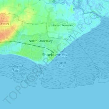
名称:Shoeburyness地形图、海拔、地势。
地点:Shoeburyness, Southend-on-Sea, Essex, England, SS3 9AB, United Kingdom (51.48974 0.75620 51.56974 0.83620)
平均海拔:3 米
最低海拔:-2 米
最高海拔:30 米
点击地图以查看其地形、其海拔和其地势。
United Kingdom > England > Essex > Southend-on-Sea > Leigh on Sea
平均海拔:22 米