
Ambur地形图
点击地图以显示海拔。
Ambur
Ambur is geographically located at 12°46′49″N 78°43′04″E / 12.780200°N 78.717700°E / 12.780200; 78.717700 with an average elevation of 346 metres (1,135 ft). It lies roughly halfway between Chennai (190 km away) and Bengaluru (161 km away). Ambur has a tropical wet-and-dry climate, reaching high temperatures during summer and experiences wet winters. The maximum rainfall occurs during October and November, with the northeast monsoon. The area also experiences light rainfall during the southwest monsoon. The temperature falls up to 12 °C low in winter. It experience a hot summer where the temperature rises up to 39 °C.
关于这张地图
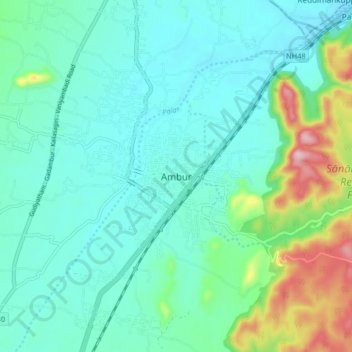
名称:Ambur地形图、海拔、地势。
地点:Ambur, Tirupattur, Tamil Nadu, 635802, India (12.74742 78.67882 12.82742 78.75882)
平均海拔:352 米
最低海拔:297 米
最高海拔:553 米