
Loburn地形图
点击地图以显示海拔。
Loburn
The Loburn-Ashley fault zone is located from the northern banks of the Ashley River through to about Hodgsons road in the north, it runs parallel to the Ashley river. The Loburn fault, which runs along the south side of Hodgsons Road, is responsible for various terraced abandoned stream channels, wedge structures and scarps, notably Round Hill. The topography in Loburn is generally flat with gently rolling hills, altitude gradually decreases southwards from the foothills.
关于这张地图
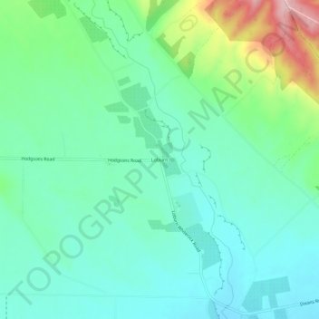
名称:Loburn地形图、海拔、地势。
平均海拔:110 米
最低海拔:60 米
最高海拔:253 米