
Whataroa地形图
点击地图以显示海拔。
关于这张地图
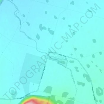
名称:Whataroa地形图、海拔、地势。
地点:Whataroa, Westland District, West Coast, New Zealand (-43.28178 170.34073 -43.24178 170.38073)
平均海拔:70 米
最低海拔:48 米
最高海拔:286 米
其他地形图
点击地图以查看其地形、其海拔和其地势。
Fox Glacier
New Zealand > West Coast > Westland District
Chancellor Hut was built in 1930–31 on the southwest face of Chancellor Ridge, now 200 m above the glacier. Planned by mountain guides Alec and Peter Graham in 1929, all the materials had to be packed up Fox Glacier manually in 1930 in the days before helicopter airlifts. It is the oldest remaining mountain…
平均海拔:1,848 米
Franz Josef Glacier
New Zealand > West Coast > Westland District
The névé or snowfield at the head of Franz Josef Glacier is over 2,500 metres (8,200 ft) above sea level and 20 square kilometres (7.7 sq mi) in area. This wide névé, which is over 300 metres (980 ft) deep, feeds large amounts of compacted snow into a steep and narrow valley which drops quickly to very low…
平均海拔:1,709 米