
Capulin地形图
点击地图以显示海拔。
关于这张地图
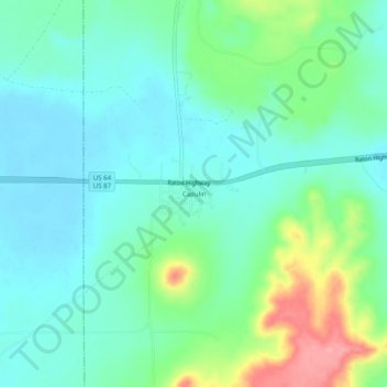
名称:Capulin地形图、海拔、地势。
地点:Capulin, Union County, New Mexico, 88414, United States (36.72108 -104.01361 36.76108 -103.97361)
平均海拔:2,098 米
最低海拔:2,069 米
最高海拔:2,181 米
其他地形图
点击地图以查看其地形、其海拔和其地势。
Clayton
United States > New Mexico > Union County
According to the United States Census Bureau, the town has a total area of 4.7 square miles (12 km2), all land. Clayton has an elevation of approximately 5,050 feet (1,540 m) above sea level. It is located about 130 miles (210 km) northwest of Amarillo, Texas. Clayton is considered to be in the Plains region…
平均海拔:1,526 米