点击地图以显示海拔。
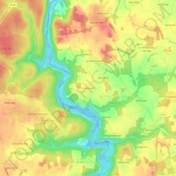
名称:Coatroual地形图、海拔、地势。
地点:Coatroual, Guidel, Lorient, Morbihan, Bretagne, France métropolitaine, 56520, France (47.79728 -3.54693 47.83728 -3.50693)
平均海拔:41 米
最低海拔:-4 米
最高海拔:72 米
点击地图以查看其地形、其海拔和其地势。
France > Bretagne > Morbihan > Guidel
平均海拔:45 米