
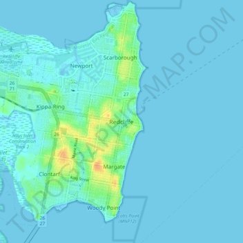
Redcliffe地形图
点击地图以显示海拔。
关于这张地图
名称:Redcliffe地形图、海拔、地势。
平均海拔:3 米
最低海拔:-2 米
最高海拔:30 米
其他地形图
点击地图以查看其地形、其海拔和其地势。
Sunshine Coast Regional
The Sunshine Coast Regional area in Queensland, Australia, features a diverse topography that ranges from coastal plains to rugged hinterlands. Along the coastline, the terrain is predominantly flat, with average elevations around 20 meters (66 feet) above sea level. Inland, the landscape transitions to…
平均海拔:56 米
City of Brisbane
Brisbane's topography is characterized by a series of hills and ranges that define its landscape. The city is situated on a low-lying floodplain, with the Brisbane River meandering through its heart, creating a winding course with many steep curves from the southwest to its mouth at Moreton Bay in the east.…
平均海拔:71 米
Mareeba
Mareeba has a tropical savanna climate (Köppen: Aw), with a short, hot wet season from December to March and a lengthy, warm dry season from April to November. Due to its elevation, average minima are lowered: ranging from 14.0 °C (57.2 °F) in August to 21.5 °C (70.7 °F) in January to February. In…
平均海拔:579 米
Minyama
Australia > Queensland > Sunshine Coast Regional
Minyama is located within the Kawana Waters urban centre. Situated on the Mooloolah River, the suburb is almost entirely surrounded by water, and artificially constructed harbours and waterways dominate the topography. The suburb's main thoroughfare, Nicklin Way, is the location of several large retail…
平均海拔:3 米
Bribie Island
Australia > Queensland > Brisbane
Bribie Island, located in Queensland, Australia, is a low-lying, elongated landmass stretching approximately 34 kilometers (21 miles) in length and up to 8 kilometers (5 miles) at its widest point. Composed predominantly of coastal sand plains, the island features two large, low-lying dunes extending…
平均海拔:6 米
Roma
Roma experiences a humid subtropical climate (Köppen: Cfa, Trewartha: Cfal); with hot summers with moderate rains; warm to hot, relatively dry springs and autumns; and mild, dry winters. Its location on the far south of the Carnarvon Range at an elevation of 299 metres above sea level means that it is cooler…
平均海拔:315 米
Lamb Island
The island is in the southern part of Moreton Bay between the Queensland mainland and North Stradbroke Island. It is within the Moreton Bay Marine Park. The elevation ranges from 0 to 26 metres (0 to 85 ft) above sea level. The land use on the island is predominantly residential.
平均海拔:4 米
Brisbane River
The RAAF also perform a practice session in the days preceding the event, serving as an opportunity to both practice beforehand and also promote Riverfire. One of the most popular RAAF aircraft to perform at Riverfire was the F-111 which was known for performing a 'dump-and-burn' above the city. The final…
平均海拔:235 米
Gatton
The area has a humid subtropical climate, with hot, humid summers and mild, sunny winters, albeit with cool nights. Heavy summer rain and warm conditions have provided ideal conditions for the areas agricultural productivity, although droughts and heatwaves can be problematic at times. Temperatures in Gatton…
平均海拔:118 米
Barron River
Australia > Queensland > Kowrowa
The Barron's headwaters start in the Mount Hypipamee National Park near Mount Hypipamee at an elevation of 1,200 metres (3,900 ft). The river then flows north 65 kilometres (40 mi) across the Atherton Tablelands before finally turning east after Mareeba towards Kuranda. After passing under the Kuranda Range…
平均海拔:360 米