
Great Saltee地形图
点击地图以显示海拔。
关于这张地图
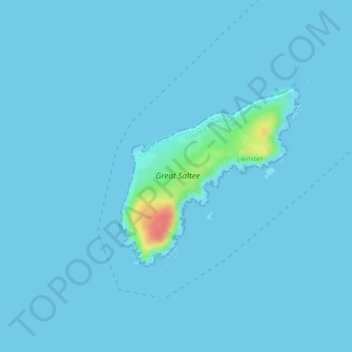
名称:Great Saltee地形图、海拔、地势。
平均海拔:2 米
最低海拔:-1 米
最高海拔:59 米
其他地形图
点击地图以查看其地形、其海拔和其地势。
Gorey
The town was granted a charter as a borough in 1619, under the name Newborough. However, as noted in A Topographical Dictionary of Ireland (published in 1837 by Samuel Lewis) and in Wexford Guide and Directory (published by George Henry Bassett in 1885), this name "never [grew] into general use" as the…
平均海拔:64 米
Ferns
The 19th-century population peaked in 1851, but never reached the levels of medieval times. Lewis's Topography of 1834 claimed the town "consists chiefly of one irregular street, and contains 106 houses indifferently built, retaining no trace of its ancient importance". The Abbey, St.Peter's Church (Catholic…
平均海拔:53 米
Taghmon
Many Irish place names are topographically descriptive, and 'Achadh Liathdrom' is no exception. From the western side of the Forth Mountain, as it slopes down towards Ballintlea, a succession of gradual hills and valleys undulate their way across this part of County Wexford towards Camross, Bree and…
平均海拔:67 米