
St Albans地形图
点击地图以显示海拔。
St Albans
St Albans was an ancient borough created following the dissolution of the monastery in 1539. It consisted of the ancient parish of St Albans (also known as the Abbey parish) and parts of St Michael and St Peter. The municipal corporation was reformed by the Municipal Corporations Act 1835 and the boundary was adjusted to additionally include part of the parish of St Stephen. In 1887 the borough gained city status, following the elevation of St Albans Abbey to cathedral, and the boundary was adjusted to include part of the parish of Sandridge.
关于这张地图
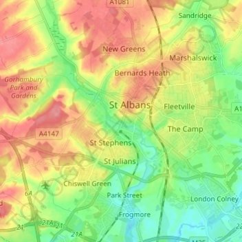
名称:St Albans地形图、海拔、地势。
平均海拔:100 米
最低海拔:64 米
最高海拔:141 米
其他地形图
点击地图以查看其地形、其海拔和其地势。