Conway地形图
点击地图以显示海拔。
关于这张地图
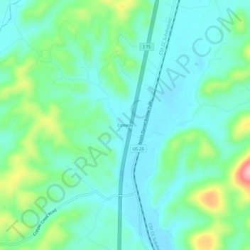
名称:Conway地形图、海拔、地势。
地点:Conway, Rockcastle County, Kentucky, United States (37.45786 -84.35438 37.49786 -84.31438)
平均海拔:332 米
最低海拔:290 米
最高海拔:462 米
其他地形图
点击地图以查看其地形、其海拔和其地势。

点击地图以显示海拔。
名称:Conway地形图、海拔、地势。
地点:Conway, Rockcastle County, Kentucky, United States (37.45786 -84.35438 37.49786 -84.31438)
平均海拔:332 米
最低海拔:290 米
最高海拔:462 米
点击地图以查看其地形、其海拔和其地势。