点击地图以显示海拔。
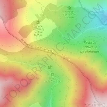
名称:Col de Portus地形图、海拔、地势。
地点:Col de Portus, Nohèdes, Prades, Pyrénées-Orientales, Occitanie, France métropolitaine, 66500, France (42.62374 2.23987 42.62384 2.23997)
平均海拔:1,702 米
最低海拔:1,219 米
最高海拔:2,150 米
点击地图以查看其地形、其海拔和其地势。
France > Occitanie > Pyrénées-Orientales > Nohèdes
平均海拔:2,185 米