Stilesboro地形图
点击地图以显示海拔。
关于这张地图
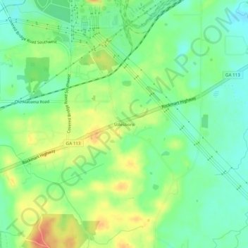
名称:Stilesboro地形图、海拔、地势。
地点:Stilesboro, Bartow County, Georgia, 30104, United States (34.08482 -84.93578 34.12482 -84.89578)
平均海拔:220 米
最低海拔:200 米
最高海拔:249 米
其他地形图
点击地图以查看其地形、其海拔和其地势。

点击地图以显示海拔。
名称:Stilesboro地形图、海拔、地势。
地点:Stilesboro, Bartow County, Georgia, 30104, United States (34.08482 -84.93578 34.12482 -84.89578)
平均海拔:220 米
最低海拔:200 米
最高海拔:249 米
点击地图以查看其地形、其海拔和其地势。