
Decide地形图
点击地图以显示海拔。
关于这张地图
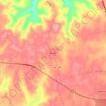
名称:Decide地形图、海拔、地势。
地点:Decide, Clinton County, Kentucky, United States (36.75340 -85.22413 36.79340 -85.18413)
平均海拔:293 米
最低海拔:202 米
最高海拔:324 米
其他地形图
点击地图以查看其地形、其海拔和其地势。
Albany
United States > Kentucky > Clinton County
Albany is located in south-central Clinton County at 36°41′36″N 85°8′7″W / 36.69333°N 85.13528°W / 36.69333; -85.13528 (36.693280, -85.135286). The city lies at an elevation of 960 feet (290 m) at the foot of the western edge of the Cumberland Plateau. Albany Rock, a western spur of the…
平均海拔:310 米