
Teaspoon Hill地形图
点击地图以显示海拔。
关于这张地图
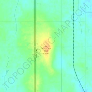
名称:Teaspoon Hill地形图、海拔、地势。
平均海拔:300 米
最低海拔:288 米
最高海拔:323 米
其他地形图
点击地图以查看其地形、其海拔和其地势。
Lansing
United States > Michigan > Ingham County
Lansing elevations range between 890 feet (271 m) above sea level on the far south side of Lansing along Northrup Street near the Cedar Street intersection, to 833 feet (254 m) to 805.5 feet (246 m) above sea level along the Grand River.
平均海拔:263 米
Lansing
United States > Michigan > Ingham County
Lansing elevations range between 890 feet (271 m) above sea level on the far south side of Lansing along Northrup Street near the Cedar Street intersection, to 833 feet (254 m) to 805.5 feet (246 m) above sea level along the Grand River.
平均海拔:263 米