Mount Kitanglad地形图
点击地图以显示海拔。
Mount Kitanglad
Due to its high elevation, several communications and broadcasting companies constructed relay stations at the summit.
关于这张地图
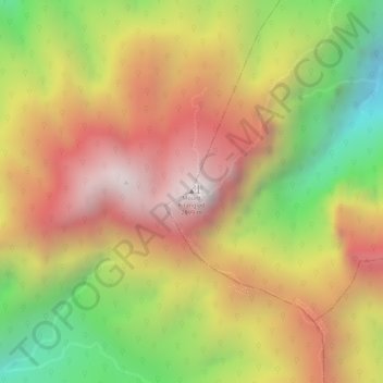
名称:Mount Kitanglad地形图、海拔、地势。
平均海拔:2,393 米
最低海拔:1,789 米
最高海拔:2,850 米

点击地图以显示海拔。
Due to its high elevation, several communications and broadcasting companies constructed relay stations at the summit.
名称:Mount Kitanglad地形图、海拔、地势。
平均海拔:2,393 米
最低海拔:1,789 米
最高海拔:2,850 米