点击地图以显示海拔。
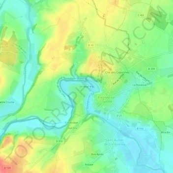
名称:Le Haut Ary地形图、海拔、地势。
地点:Le Haut Ary, Fresnay-sur-Sarthe, Mamers, Sarthe, Pays de la Loire, France métropolitaine, 72130, France (48.26374 -0.00495 48.30374 0.03505)
平均海拔:96 米
最低海拔:68 米
最高海拔:139 米
点击地图以查看其地形、其海拔和其地势。
France > Pays de la Loire > Sarthe > Fresnay-sur-Sarthe
平均海拔:82 米
平均海拔:91 米