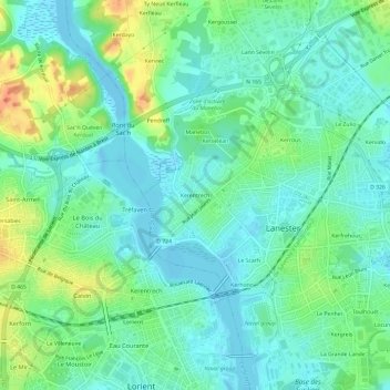
点击地图以显示海拔。
名称:Kerentrech地形图、海拔、地势。
地点:Kerentrech, Lanester, Lorient, Morbihan, Bretagne, France métropolitaine, 56600, France (47.74735 -3.37789 47.78735 -3.33789)
平均海拔:15 米
最低海拔:-4 米
最高海拔:48 米
点击地图以查看其地形、其海拔和其地势。
France > Bretagne > Morbihan > Lanester > Le Mane
平均海拔:19 米