点击地图以显示海拔。
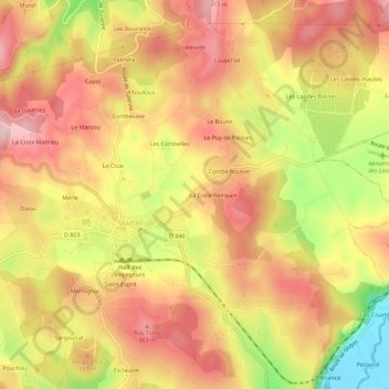
名称:Lasserre地形图、海拔、地势。
地点:Lasserre, Martel, Gourdon, Lot, Occitanie, France métropolitaine, 46600, France (44.92020 1.59910 44.96020 1.63910)
平均海拔:243 米
最低海拔:109 米
最高海拔:325 米
点击地图以查看其地形、其海拔和其地势。
France > Occitanie > Lot > Martel > Le Guilleries
平均海拔:262 米