
Phakding地形图
点击地图以显示海拔。
Phakding
Phakding is a small village in the Khumbu region of Nepal. It lies in the Dudh Kosi river valley just north of Lukla and south of Monjo, at an altitude of 2,610 m. It has been a UNESCO World Heritage Site since 1979. Phakding has a population of 550 locals, mostly Sherpa and Tamang. All of these people belong to Tibetan Buddhism and pray in a small Gompa at the centre of the village.
关于这张地图
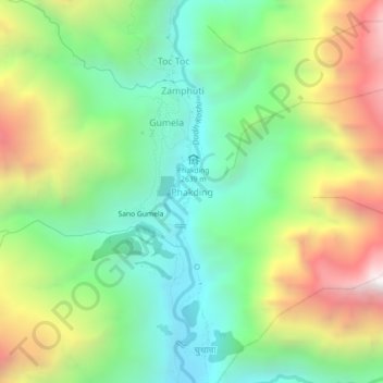
名称:Phakding地形图、海拔、地势。
地点:Phakding, Khumbupasanglahmu, Solukhumbu, Koshi Province, Nepal (27.72013 86.69269 27.76013 86.73269)
平均海拔:3,111 米
最低海拔:2,503 米
最高海拔:4,121 米
其他地形图
点击地图以查看其地形、其海拔和其地势。