
Mount Meharry地形图
点击地图以显示海拔。
Mount Meharry
The summit of Mount Meharry can be reached from the Great Northern Highway via an unsealed road 16 kilometres (9.9 mi) in length and a vehicular track 21 kilometres (13 mi) in length. Permission should be sought from the managers of the land over which the road and track pass. These are Juna Downs Station and the Department of Parks and Wildlife, which manages Karijini National Park. In dry conditions, a two-wheel-drive vehicle can reach the national park boundary at about 800 metres (2,600 ft) elevation, requiring a walk of about 7 kilometres (4.3 mi) to the summit.
关于这张地图
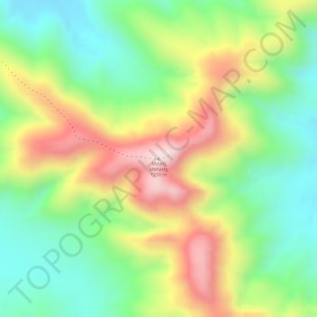
名称:Mount Meharry地形图、海拔、地势。
平均海拔:1,030 米
最低海拔:859 米
最高海拔:1,247 米
其他地形图
点击地图以查看其地形、其海拔和其地势。
Katanning
Katanning railway station has an elevation of 1,024 feet (312 m) above sea level and a rail distance of 225 miles (362 km) from Perth.
平均海拔:323 米
Rockingham
Rockingham is topographically flat, has sandy soils and coastal vegetation. It has a northern aspect to Cockburn Sound, from Rockingham Beach and Palm Beach.
平均海拔:4 米