
Cawdor地形图
点击地图以显示海拔。
关于这张地图
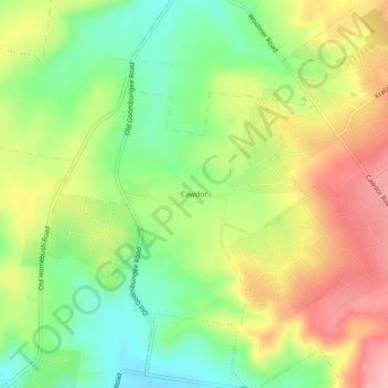
名称:Cawdor地形图、海拔、地势。
平均海拔:574 米
最低海拔:500 米
最高海拔:663 米
其他地形图
点击地图以查看其地形、其海拔和其地势。
Top Camp
Australia > Queensland > Toowoomba
Top Camp is 9 kilometres (6 mi) from the Toowoomba city centre via the New England Highway. It is immediately to the west of the Great Dividing Range and is at an elevation of 580 to 630 metres (1,900 to 2,070 ft).The highway passes through the eastern part of the locality from north (Kearney Springs) to south…
平均海拔:604 米