
Toluca地形图
点击地图以显示海拔。
Toluca
Toluca is located at 2600 meters above sea level, being the highest capital city in Mexico and North America, which makes it temperate throughout the year with average temperatures ranging between 6 and 25 degrees Celsius during spring and summer, and from −5 to 20 degrees Celsius in winter. Its climate is temperate subhumid with rain in summer. Its altitude favors the practice of high-performance sports, but as it is one of the most polluted cities in the country due to the emissions of its industrial corridor and the poor motorized public transportation of the last 3 years, outdoor exercise carries some risks for health.
关于这张地图
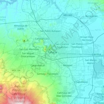
名称:Toluca地形图、海拔、地势。
地点:Toluca, State of Mexico, 50000, Mexico (19.13255 -99.81690 19.45255 -99.49690)
平均海拔:2,729 米
最低海拔:2,547 米
最高海拔:3,996 米
其他地形图
点击地图以查看其地形、其海拔和其地势。