点击地图以显示海拔。
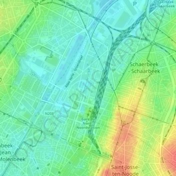
名称:Parc Gaucheret地形图、海拔、地势。
地点:Parc Gaucheret, Quartier Nord, Schaerbeek, Bruxelles, Bruxelles-Capitale, 1030, Belgique (50.86321 4.35907 50.86574 4.36127)
平均海拔:29 米
最低海拔:11 米
最高海拔:64 米
点击地图以查看其地形、其海拔和其地势。
Belgique > Bruxelles-Capitale > Schaerbeek
平均海拔:47 米