
Eagle Mountain地形图
点击地图以显示海拔。
Eagle Mountain
Eagle Mountain is only about 12 miles (19 km) from Minnesota's lowest elevation, Lake Superior, at 600 feet (183 m). It is part of the Canadian Shield. There is also another much shorter peak also named Eagle Mountain in northern Minnesota. The shorter peak is part of the Lutsen Mountains ski resort.
关于这张地图
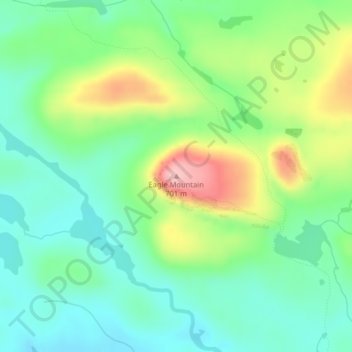
名称:Eagle Mountain地形图、海拔、地势。
平均海拔:596 米
最低海拔:545 米
最高海拔:697 米
其他地形图
点击地图以查看其地形、其海拔和其地势。
Brule Lake
United States > Minnesota > Cook County > West Cook
Brule Lake lies in a region which has seen human population since the end of the last ice age. It has variously been within the territory of the Dakota, Cree, Ojibwa, French, British, and Americans. It saw little development until the opening of a railroad that allowed loggers easier access to the interior of…
平均海拔:579 米