
Grabouw地形图
点击地图以显示海拔。
Grabouw
The Elgin valley is South Africa's coolest climate wine-growing region and a range of other geographic factors (for example, its proximity to the Atlantic Ocean, cool temperatures, plentiful winter rainfall, prevailing wind directions, and altitude) have created a set of conditions for wine growing which are markedly different to those in surrounding areas. Of the many varietals grown in the region, special attention has been paid to Sauvignon Blanc and Pinot Noir.
关于这张地图
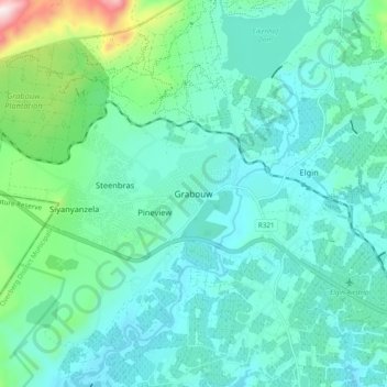
名称:Grabouw地形图、海拔、地势。
平均海拔:358 米
最低海拔:247 米
最高海拔:878 米
其他地形图
点击地图以查看其地形、其海拔和其地势。