
Chapada Diamantina地形图
点击地图以显示海拔。
Chapada Diamantina
The Chapada Diamantina lies at the center of Bahia State and forms the northern part of the Espinhaço Mountain Range. The region is approximately 38,000 km2 (15,000 sq mi) in area and encompasses 58 municipalities. Technically, this region is considered a part of the caatinga biome, and contains some of its highest elevations, most of it above 500 metres (1,600 ft). The vegetation; a product of the physiographic conditions, is known as cerrado, and consists of rocky plains, dry forests, and caatinga desert vegetation, all of which harbour a great deal of biodiversity and unique endemisms. The region is considered to have a Mesotermic climate, of the Cwb type, according to Köppen Climate classifications. It is normally quite cooler than its surrounding areas, with an average annual temperature under 22 °C. The territory of the Chapada Diamantina runs roughly between the cities of Mucugê (13°00′S 41°22′W / 13.000°S 41.367°W / -13.000; -41.367) to the south, Andaraí (12°48′S 41°20′W / 12.800°S 41.333°W / -12.800; -41.333) in the southeast, Lençóis (12°33′S 41°23′W / 12.550°S 41.383°W / -12.550; -41.383) in the northeast, and Palmeiras (12°31′S 41°35′W / 12.517°S 41.583°W / -12.517; -41.583) in the northwest. This region is named the Serra do Sincorá Ridge. However, the city of Ibicoara, near the southern limits of Chapada Diamantina, is also becoming important. The Sincorá Ridge is North–South oriented and has a length of 160 km and 20 to 30 km of width.
关于这张地图
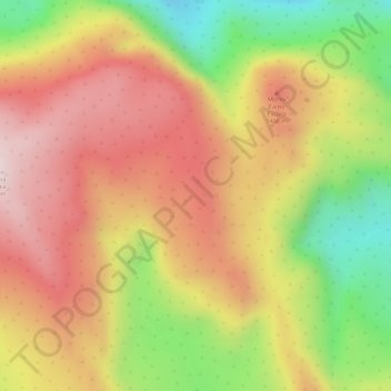
名称:Chapada Diamantina地形图、海拔、地势。
平均海拔:1,390 米
最低海拔:1,131 米
最高海拔:1,571 米