
Caruso地形图
点击地图以显示海拔。
关于这张地图
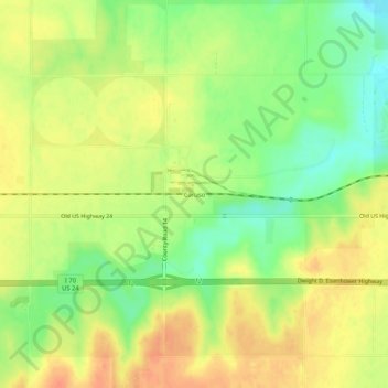
名称:Caruso地形图、海拔、地势。
平均海拔:1,135 米
最低海拔:1,110 米
最高海拔:1,154 米
其他地形图
点击地图以查看其地形、其海拔和其地势。
Goodland
United States > Kansas > Sherman County
Goodland is located at 39°21′3″N 101°42′37″W / 39.35083°N 101.71028°W / 39.35083; -101.71028 (39.3508330, −101.7101722) at an elevation of 3,681 feet (1,122 m). It lies on the south side of the Middle Fork of Sappa Creek, part of the Republican River watershed, in the High Plains region…
平均海拔:1,120 米