Buffalo City地形图
点击地图以显示海拔。
关于这张地图
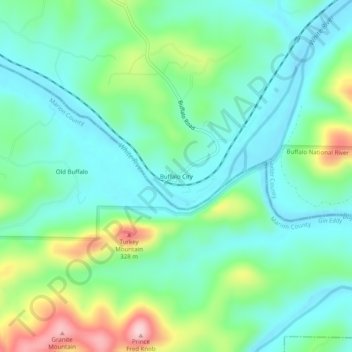
名称:Buffalo City地形图、海拔、地势。
地点:Buffalo City, Baxter County, Arkansas, United States (36.14785 -92.46210 36.18785 -92.42210)
平均海拔:176 米
最低海拔:110 米
最高海拔:351 米
其他地形图
点击地图以查看其地形、其海拔和其地势。

点击地图以显示海拔。
名称:Buffalo City地形图、海拔、地势。
地点:Buffalo City, Baxter County, Arkansas, United States (36.14785 -92.46210 36.18785 -92.42210)
平均海拔:176 米
最低海拔:110 米
最高海拔:351 米
点击地图以查看其地形、其海拔和其地势。