
Burris地形图
点击地图以显示海拔。
关于这张地图
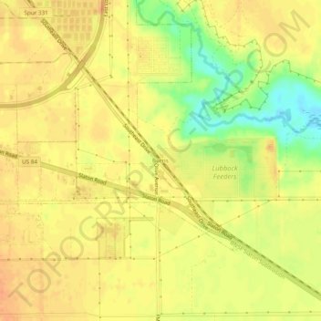
名称:Burris地形图、海拔、地势。
地点:Burris, Lubbock County, Texas, United States (33.50481 -101.79961 33.54481 -101.75961)
平均海拔:960 米
最低海拔:933 米
最高海拔:971 米
其他地形图
点击地图以查看其地形、其海拔和其地势。
Lubbock
United States > Texas > Lubbock County
Summers are hot, with 78 afternoons on average of 90 °F (32.2 °C)+ highs and 7.4 afternoons of 100 °F (37.8 °C)+ highs, although due to the aridity and elevation, temperatures remain above 70 °F (21.1 °C) on only a few mornings. Lubbock is the 10th-windiest city in the US with an average wind speed of…
平均海拔:983 米