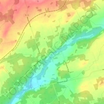
点击地图以显示海拔。
名称:Lonsdale地形图、海拔、地势。
地点:Lonsdale, Tyendinaga, Hastings County, Central Ontario, Ontario, Canada (44.25536 -77.14667 44.29536 -77.10667)
平均海拔:119 米
最低海拔:79 米
最高海拔:157 米
点击地图以查看其地形、其海拔和其地势。
Canada > Ontario > Hastings County > Wollaston
平均海拔:349 米
Canada > Ontario > Hastings County
平均海拔:319 米
平均海拔:355 米