Tripoint hydrographique地形图
点击地图以显示海拔。
关于这张地图
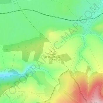
名称:Tripoint hydrographique地形图、海拔、地势。
平均海拔:1,242 米
最低海拔:1,133 米
最高海拔:1,408 米
其他地形图
点击地图以查看其地形、其海拔和其地势。

点击地图以显示海拔。
名称:Tripoint hydrographique地形图、海拔、地势。
平均海拔:1,242 米
最低海拔:1,133 米
最高海拔:1,408 米
点击地图以查看其地形、其海拔和其地势。