点击地图以显示海拔。
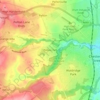
名称:Pelton Fell地形图、海拔、地势。
地点:Pelton Fell, Durham, County Durham, North East, England, DH2 2QA, United Kingdom (54.83766 -1.62758 54.87766 -1.58758)
平均海拔:76 米
最低海拔:10 米
最高海拔:140 米
点击地图以查看其地形、其海拔和其地势。
United Kingdom > England > County Durham > Durham
United Kingdom > England > County Durham > Durham > Houghall
平均海拔:68 米
平均海拔:81 米