
Gormanston地形图
点击地图以显示海拔。
关于这张地图
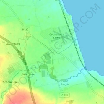
名称:Gormanston地形图、海拔、地势。
平均海拔:18 米
最低海拔:0 米
最高海拔:59 米
其他地形图
点击地图以查看其地形、其海拔和其地势。
Julianstown
Julianstown was the seat of the Moore family who lived in Julianstown House and occupied the land that now contains the townland of Julianstown West. Taylor and Skinner's 1783 Road Map of Ireland refers to the Moore seat and also shows the Church of Ireland church which still stands today. There is little…
平均海拔:20 米