
Great Dun Fell地形图
点击地图以显示海拔。
Great Dun Fell
Under the Köppen climate classification, Great Dun Fell has a subpolar oceanic climate (Cfc), closely bordering both a subarctic climate (Dfc) under the 0 °C (32 °F) isotherm and an alpine tundra climate (ET) due to a July mean of exactly 10 °C (50 °F). The Met Office station publishes only temperature, wind and frost averages. The summers are cool due to elevation. Considering its elevation and a latitude of over 54 degrees, winters are relatively mild due to oceanic influences.
关于这张地图
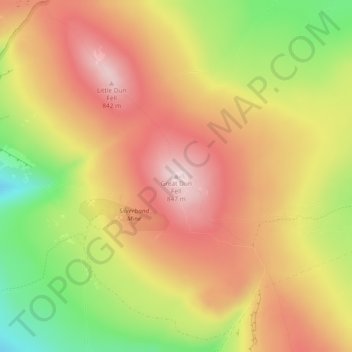
名称:Great Dun Fell地形图、海拔、地势。
平均海拔:713 米
最低海拔:526 米
最高海拔:851 米