点击地图以显示海拔。
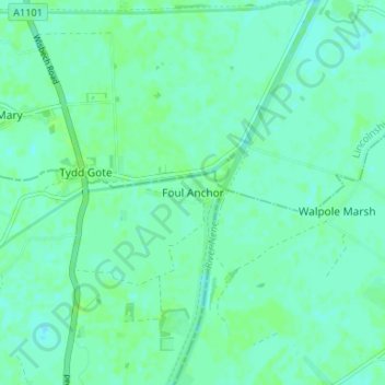
名称:Foul Anchor地形图、海拔、地势。
地点:Foul Anchor, Fenland District, Cambridgeshire, Cambridgeshire and Peterborough, England, PE13 5RF, United Kingdom (52.71757 0.14634 52.75757 0.18634)
平均海拔:4 米
最低海拔:0 米
最高海拔:8 米
点击地图以查看其地形、其海拔和其地势。
United Kingdom > England > Cambridgeshire > Fenland District
平均海拔:1 米
平均海拔:2 米
平均海拔:3 米
平均海拔:0 米