
Mahendragiri地形图
点击地图以显示海拔。
Mahendragiri
Mahendragiri, is a mountain in Rayagada block of the district of Gajapati, Odisha, India. It is situated amongst the Eastern Ghats at an elevation of 1,501 metres (4,925 ft). The second highest mountain of Odisha.
关于这张地图
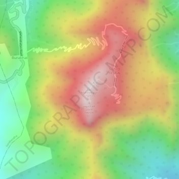
名称:Mahendragiri地形图、海拔、地势。
地点:Mahendragiri, Burakhat, Ramagiri, Gajapati, Odisha, India (18.96629 84.36479 18.96639 84.36489)
平均海拔:1,108 米
最低海拔:711 米
最高海拔:1,494 米